ERA-NET CRUE
|
|
Case Studies
Flanders
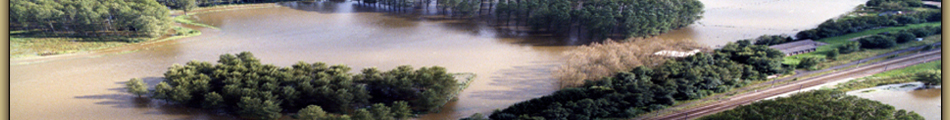
The case study of the partner Soresma is the Demer river basin (1920km²) in Flanders. It is a typical lowland river, almost completely canalized and part of the Scheldt river basin. Periods of heavy, long lasting rainfall caused severe flooding in the past. As a consequence of the historical floods of 1965 and 1966, the responsible authorities implemented typical engineering measures such as widening and deepening of the river, eliminating meanders and the construction of high dikes. This engineering approach however could not eliminate floods completely.
A paradigm shift towards integrated water management has resulted in a new integrated water management plan for the Demer river (co-developed by Soresma) in 2007. It is one of the first plans in Europe that integrates flood protection habitat restoration, farming, spatial planning and recreational development. As a consequence of the major flood of 1998 Soresma developed an operational flood forecasting and warning system for the Demer basin. Since 2003 three modules (observation, forecast and warning) are fully operational, and available as on-line information on the website www.overstromingsvoorspeller.be. In addition, a complete flood risk assessment is available including flood probability maps and associated damage maps. For the development plan of the Demer, besides technical development, as well a stakeholder analysis has been performed and actual stakeholder participation has been applied practically.
Leine-Innerste catchment
The Leine/Innerste catchment is a sub catchment of the Weser watershed. It is a rain-fed catchment with occasional snow-melting water from the mid-range mountains Harz and its Northwestern foothills respectively. The main urban settlement with high potential of flood threat is Hildesheim. Subsequent of the flood event at the Elbe 2002 and 2006 as well as the in the Leine-Innerste catchment in 2007, the province of Niedersachsen released several new flood prevention and mitigation regulations and measures. As a direct outcome of one of these measures, a map of the most vulnerable river sections in the German province of Niedersachsen was generated.
Specifically for the Leine catchment an action plan Gewässerentwicklungsplan für die mittlere Leine was designed and published in 2007. This plan contains an inventory of land use as well as objectives and measures for flood prevention, protection and mitigation in the region. For the communication and interaction between authorities and stakeholders the co-operation Gebietskooperation 20 Leine-Innerste plays a central role. Besides the responsible authorities representatives from nature protection, agriculture, fishery and navigation, also a number of NGO are part of this cooperation.
Vibo Valencia and Soverato
In Italy the flood prone areas chosen for this project are situated in the Calabria region (South Italy). More than 90% of the 15km² is covered by hills and mountains that belong to Apennine Mountain Range. Due to the rough orography of this region and the quick hydrologic response of most watersheds, the floods develop rapidly during the rainy season and suddenly inundate the areas downstream. Apart of these flash floods from torrents and creeks, the region is exposed to costal floods projected to increase as the sea level rises. Calabria is located between the Tyrrhenian Sea to the west and the Ionian Sea to the east.
The specific events to be revisited in this project include the 2000 flood in Soverato and 2006 flood in Vibo Valentia. A thousand year flood along the torrent Beltrame on September 10th 2000, wiped out a camping situated too closely to the river's estuary. The flood killed 13 visitors, many of which were physically impaired people. The torrential precipitations caused damage also to neighbourhood area including Soverato town, home of ten thousands. In the aftermath of the event several lawsuits were filed against the local authority for failing to close down the camping in time to prevent the catastrophe, against the operator of the camping, and against the regional authority which issued the planning permission for the camping in such proximity to the water course. An important question addressed in these lawsuits was the extent to which the event could have been anticipated, using the existent flood models.
The 2006 flood in Vibo Valentia, triggered by torrential precipitation, took place only some 60 km far from Soverato but on the opposite, Tyrrhenian Sea coast. Vibo Valentia is a district town and home of 30 thousands. On July 3rd, 2006 a total accumulated rainfall of more than 190 mm was registered within a period of only three hours. Despite the contained extent of affected area - accounting to some 15 km² - the damage was huge and four people lost live. State of emergency was declared for the area. In aftermath a lawsuit was filed against the Department for Civil Protection for the failure to issue warning.